
Precision Measurement. Smarter Resource Management.

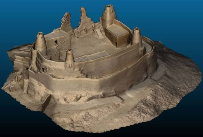
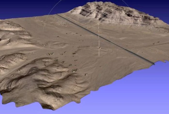
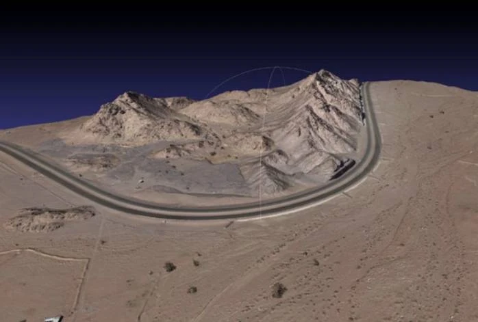
At GSC, we deliver high-accuracy volumetric mapping and modeling solutions designed for large-scale and complex environments — from mine sites and quarries to landfills, agricultural zones, and development projects, even in the most remote locations.

Using our advanced PPK-enabled mapping drones integrated with RTK ground control, we capture data with exceptional precision — achieving 1.5–3 cm accuracy across vast areas. The result: fast, safe, and verifiable volume calculations that empower clients to make smarter, data-driven decisions.

Accuracy

Our drone-based volumetric assessments deliver measurement accuracy far beyond traditional survey methods. When equipped with the right sensors and flight configurations, our systems achieve centimeter-level precision — ensuring reliable data for engineering, planning, and operational management.

Efficiency

Drones dramatically reduce the time and cost associated with manual measurements. Large areas can be surveyed in a fraction of the time, providing near real-time results that keep projects on schedule and teams informed.

Accountability

By providing continuous, verifiable aerial records, GSC’s volumetric assessments promote transparency and accountability. They are particularly valuable in mining and excavation operations, where consistent monitoring helps prevent illegal activity, manage inventory, and verify compliance.

Accessibility

Our drones safely access hazardous, unstable, or hard-to-reach areas, eliminating risk to personnel while maintaining the highest data quality standards.

Project Outputs

Our aerial orthophotos deliver crisp, ortho-rectified imagery with exceptional detail — achieving 2.0 cm/pixel resolution, nearly 10 times higher than typical satellite imagery. Every image is pre-sorted, color-balanced, and sharpened to produce vivid, high-contrast visuals that support accurate measurement and analysis.

The DSM provides an exact representation of the earth’s first visible surface — including terrain, vegetation, and man-made structures. These models are essential for 3D visualization, topographic analysis, and location-based simulations, helping clients better understand site characteristics and elevation variations.

Our DTMs are processed at maximum precision, offering multiple resolution outputs — down to 1m cell size. These models integrate seamlessly with industry-standard platforms including ESRI ArcGIS, Cesium, AutoCAD, and MicroStation, supporting a wide range of engineering and geospatial applications.

Our architectural and CAD teams translate aerial data into detailed 2D master plan drawings, complete with contours, spot elevations, boundaries, and ground control points (GCPs). Visible surface elements — such as light poles, trees, buildings, and manholes — are accurately traced to create a precise, data-rich base map.

Derived from high-resolution DTM data, our contour maps elegantly visualize topographic variations — from gentle slopes to deep depressions. When combined with orthophotos or DSM data, they provide a powerful tool for terrain analysis, site design, and visual exploration.

We produce photorealistic, geo-referenced 3D mesh models with exceptional detail and texture accuracy. Delivered as .OBJ and .MTL files generated via Pix4D, these models offer immersive visualization ideal for design reviews, simulation, and digital twin applications.

We generate high-density, true-color point clouds in LAS format, providing engineers and designers with precise 3D spatial data for measurement, modeling, and advanced analysis.

Each project concludes with a comprehensive Aerial and Land Survey Report, documenting all methodologies, QA/QC processes, equipment specifications, data accuracy, and coordinate system details. These reports provide full transparency and traceability — reinforcing the reliability and integrity of every dataset we deliver.

Change Detection Report

To complement our volumetric analysis, GSC provides quarterly Change Detection Reports using state-of-the-art change detection and object extraction technology.

By analyzing a time series of high-resolution earth observation (EO) images, we identify terrain or structural changes over time. The process includes radiometric calibration for accurate comparison and terrain correction to eliminate geometric distortions — ensuring that every detected change is both meaningful and measurable.

This level of temporal analysis empowers clients to track progress, monitor environmental impact, and manage resources with confidence.